Myrtos Beach, Kefalonia | Exploring Greece
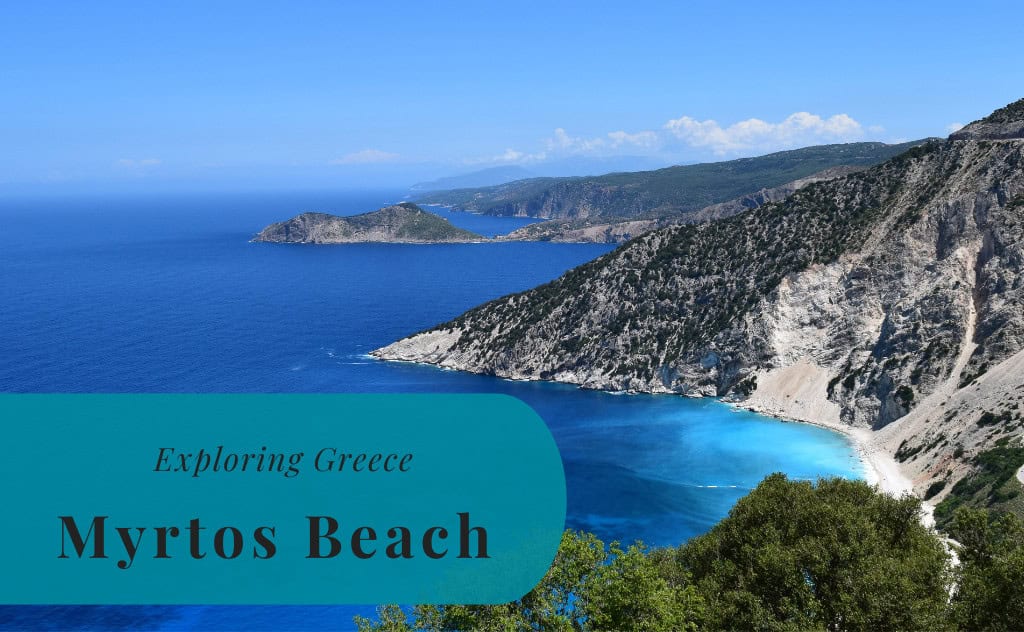
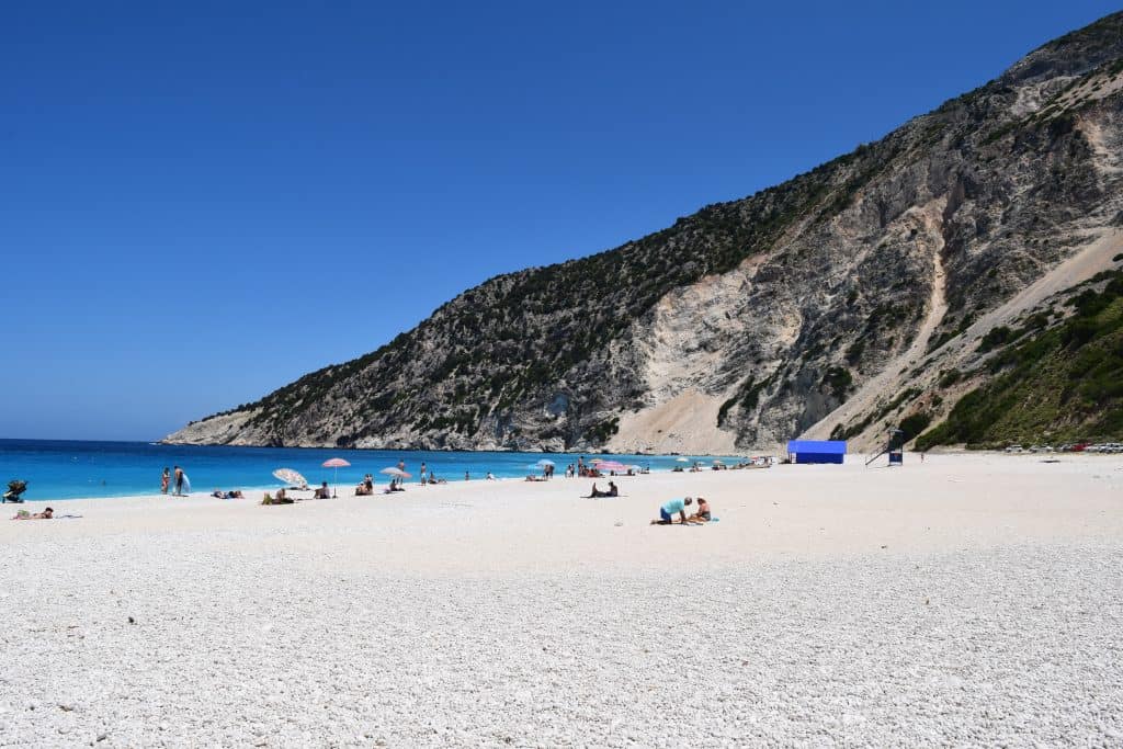
Myrtos Beach is a world-famous beach located on the northwestern coast of the island of Kefalonia, which is one of the Ionian Islands in Greece. It is a part of the Pylaros municipal unit. Myrtos is not a town or a village, but rather a stunning natural landmark. It is renowned for its dramatic scenery, its arc of dazzling white pebbles, and its incredibly clear, turquoise-colored water. The beach is consistently ranked as not only one of the best in Greece but also in the entire world.
The identity of Myrtos is that of a wild and unspoiled natural wonder. The beach is set at the base of two towering limestone cliffs, Agia Dynati and Kalon Oros, which create a spectacular and dramatic backdrop. Its fame was significantly boosted after it was featured in the 2001 film Captain Corelli’s Mandolin. Today, Myrtos is one of the most photographed beaches in the world, and it is the signature image of Kefalonia. Its natural beauty and its iconic status make it an essential destination for any visitor to the island.

History of Myrtos Beach
The history of Myrtos Beach is primarily a geological one, a story of how natural forces have created a landscape of unique beauty. The beach and its surrounding cliffs have been shaped over millions of years by the movement of the earth and the erosion from the sea. The human history of the beach is much more recent. For centuries, it was a remote and inaccessible part of the coastline, known only to local shepherds and fishermen. Its transformation into a world-famous tourist destination is a phenomenon of the late 20th century.
Geological Formation
The magnificent scenery of Myrtos Beach is a direct result of the region’s unique geology. The beach is composed not of sand, but of millions of small, smooth white pebbles and coarse sand that have been rounded by the sea. These white pebbles are what give the water its famous, brilliant turquoise color, as they reflect the sunlight. The beach is set at the base of towering limestone cliffs, which are part of a major fault line. Landslides from these cliffs over thousands of years have also contributed to the formation of the beach.
A Remote and Wild Place
For most of its history, Myrtos was a wild and inaccessible place. There was no road leading down to the beach, so it was known only to a few locals. The area was used for grazing goats, and its name is believed to have come from the myrtle plants that grow on the surrounding slopes. The beach remained largely untouched by human development for centuries. Its isolation was a key part of its pristine character. This began to change in the latter half of the 20th century with the development of tourism on the island.
The Road and Modern Fame
A major turning point in the history of Myrtos was the construction of the asphalt road that winds its way down the steep cliff face to the beach. This road made the beach accessible to the public for the first time. Its international fame, however, was cemented in 2001 when it was used as a major filming location for the Hollywood movie Captain Corelli’s Mandolin, which was set on Kefalonia. The stunning images of the beach in the film brought it to the attention of a global audience, and it has been one of the most famous beaches in the world ever since.

Sights in Myrtos Beach
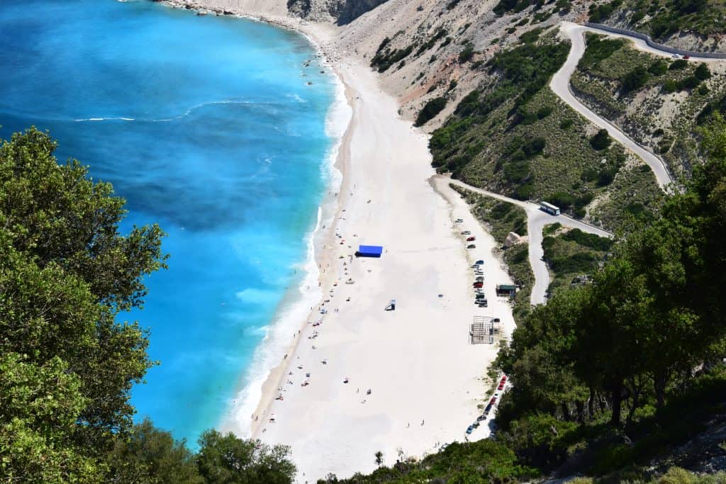
The sights at Myrtos Beach are entirely focused on its spectacular natural beauty. The main attraction is, of course, the magnificent beach itself, with its dazzling white pebbles and its iconic turquoise water. The view of the beach from the road high above on the cliffs is another major highlight, and it is one of the most famous and photographed viewpoints in all of Greece. At the northern end of the beach, there are also several interesting sea caves that can be explored by swimmers.
The Beach Itself
Myrtos Beach is the main sight. It is a long, curving stretch of smooth, white marble pebbles and coarse white sand. The beach is famous for its dramatic setting, nestled at the base of two towering limestone cliffs. The water at Myrtos is renowned for its clarity and its stunning range of colors, which change throughout the day from a deep blue to a brilliant turquoise. The beach has been awarded the Blue Flag for its cleanliness and water quality. It is a truly spectacular natural wonder.
The Viewpoint from Above
One of the most famous and essential experiences at Myrtos is the view from the viewpoint on the main coastal road high above the beach. This spot offers a breathtaking panoramic view of the entire bay, the curving white beach, and the incredible colors of the sea. The viewpoint is a very popular spot for taking photos, especially in the late afternoon and at sunset when the light is at its best. There is a dedicated platform where you can safely stop to admire and photograph this iconic landscape.
The Sea Caves
At the northern end of Myrtos Beach, there are several small sea caves that have been carved into the base of the limestone cliffs. These caves are accessible by swimming from the main beach. Exploring these caves is a fun and adventurous activity for strong swimmers. The largest of the caves has a small, hidden beach inside. The water inside the caves is often a brilliant shade of blue, and they provide a unique perspective of the beach and its geology.


Traveling with Kids
Myrtos Beach can be a wonderful destination for families with children, but it does require some caution. The sheer beauty of the beach and the fun of playing on the white pebbles are a great experience for kids. However, parents should be aware that the seabed at Myrtos shelves quite steeply, meaning the water gets deep very quickly just a few meters from the shore. The beach can also have strong waves when the wind is from the northwest. For these reasons, it is best suited for families with older children who are confident swimmers.
The beach has some basic amenities that are useful for families, including a small kiosk that sells snacks and drinks, as well as sunbeds and umbrellas for rent. There are no formal playgrounds at the beach, as it is a protected natural area. The main activity is simply enjoying the sun, the sea, and the spectacular natural surroundings. For families with very young children, some of the more shallow and sheltered beaches on the island might be a more suitable option.

How to Get to Myrtos Beach?
Myrtos Beach is located on the northwestern coast of the island of Kefalonia in Greece. The beach is situated between the villages of Divarata and Asos. The main gateway to the island is Kefalonia International Airport (EFL). The island is also connected by ferry to the Greek mainland and to other nearby islands. Once you are on the island, Myrtos Beach is accessible via a scenic coastal road.
Arriving by Air
The main airport on the island is Kefalonia International Airport ”Anna Pollatou” (EFL). The airport is located in the southern part of the island, near the capital city of Argostoli. It is served by numerous airlines, especially during the summer tourist season, with direct charter and scheduled flights from many cities across Europe. From the airport, the easiest way to reach Myrtos Beach is to rent a car. The drive takes approximately 45-50 minutes.
Arriving by Ferry
Kefalonia is well-connected by ferry to the Greek mainland and to other Ionian Islands. The main ports on the island are in Sami and Poros. There are frequent ferry services from the port of Patras and Kyllini on the Peloponnese peninsula to Kefalonia. From the port of Sami, which is the closest major port to Myrtos, the drive to the beach takes about 30 minutes.
Driving to the Beach
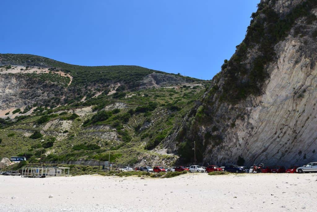
Driving to Myrtos is a scenic adventure in itself. The beach is located about 30 kilometers from the capital, Argostoli. The main coastal road that runs along the western side of the island is famous for its spectacular views. The final approach to Myrtos is the famous winding road that descends the steep cliff face down to the beach. This road offers the iconic and breathtaking view of the bay that is seen in all the famous photographs.
Connecting by Bus
The public bus system on Kefalonia is operated by the KTEL bus company. During the peak summer season, there is a dedicated bus route that connects the main town of Agia Efimia with Myrtos Beach. This service may run a few times a day. Additionally, the long-distance bus service between Argostoli and Fiskardo passes by the top of the road leading down to Myrtos. You can ask the driver to stop at the viewpoint, but you would then have a long walk down the winding road to the beach.
Driving Distances
The driving distance from 20 local places, according to Google Maps:
- Divarata, Kefalonia – 2 kilometers (0 h 05 min)
- Asos, Kefalonia – 10 kilometers (0 h 20 min)
- Agia Efimia, Kefalonia – 13 kilometers (0 h 20 min)
- Zola, Kefalonia – 15 kilometers (0 h 25 min)
- Karavomylos, Kefalonia – 18 kilometers (0 h 30 min)
- Sami, Kefalonia – 19 kilometers (0 h 30 min)
- Agia Kyriaki Beach, Kefalonia – 20 kilometers (0 h 35 min)
- Antisamos Beach, Kefalonia – 24 kilometers (0 h 40 min)
- Fiskardo, Kefalonia – 28 kilometers (0 h 45 min)
- Petani Beach, Kefalonia – 28 kilometers (0 h 50 min)
- Argostoli, Kefalonia – 29 kilometers (0 h 50 min)
- Lixouri, Kefalonia – 30 kilometers (0 h 50 min)
- Lassi, Kefalonia – 31 kilometers (0 h 55 min)
- Kefalonia Airport (EFL) – 36 kilometers (1 h 00 min)
- Svoronata, Kefalonia – 37 kilometers (1 h 00 min)
- Xi Beach, Kefalonia – 38 kilometers (1 h 05 min)
- Lourdas, Kefalonia – 40 kilometers (1 h 05 min)
- Poros, Kefalonia – 43 kilometers (1 h 05 min)
- Katelios, Kefalonia – 48 kilometers (1 h 15 min)
- Skala, Kefalonia – 53 kilometers (1 h 20 min)
Looking to Explore more of Greece and Europe?